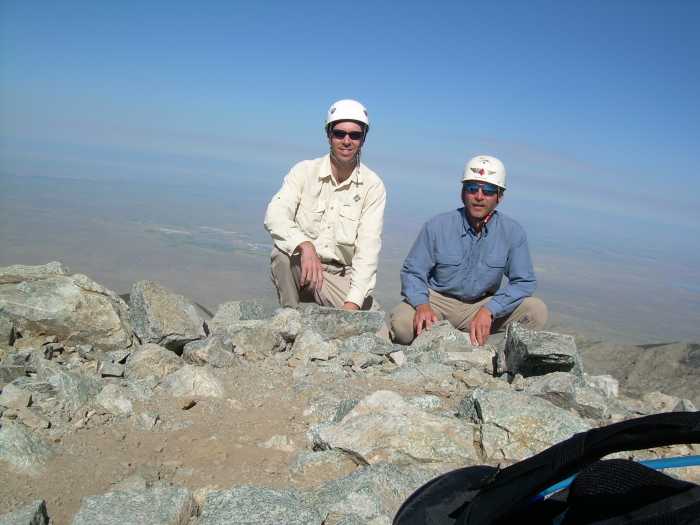
The Adventure Family Race Team has been at it again! Don and Patrick teamed up with Chris K as support crew to compete in the 2008 Tidewater Traverse, a 16 hour adventure race near Williamsburg, Virginia put on by HR Adventures. This race started at 8pm on June 28th, so much of the race was in the dark, which was fine because the daytime high was predicted to be about 100 degrees!
Also racing in this event were Brain T and Marcilynn as “Team GoofyAss”. They’re from the TrailBlazers RDU chapter too. Todd and Christine of the “Isotopes” were racing. Daiwai, Carmen and Missy raced as “Our People Don’t Run”. I saw a number of other familiar faces from the southeastern AR community there as well. There were over 100 racers participating.
At race checkin, we were given a big map and coordinates for the last two thirds of the race. The race started with teams being divided up into three groups and being sent on a scavenger hunt throughout Chippokes State Park. We had to find a series of five locations where we answered a question and got the next clue’s location. The fifth clue led us back to the start area where we were given the coordinates of the first third of the race, and a supplemental map for that section.
We started out on bike and headed for CP 1. Brian and Marcilynn soon passed by us as we headed towards the park exit. We tried momentarily to keep up with them, but then remembered our plan to run our own race. As we got closer to the exit, we came upon a spot where, on the way in earlier, we had noticed a riverside greenway that paralleled the road. The grassy area separating the two was mowed and only 50 feet across. While all the other teams, GoofyAss included, continued up the road, I led us over to the greenway. We took off down the greenway and soon realized that no one had followed us – good. Now, where were we going? Oh yeah, CP1. The only clue was the word “beach”. The only map of this area that we had was the skimpy park map. It had “Beach access” up in one corner, near where we were, but it wasn’t specific. So we rode along looking for something. There was a buffer of brush and trees between us and the riverside beach. A little further on we saw a path through the brush. At the second path like that I stopped. The greenway beyond here curved away from the beach and headed up a bluff. I suggested to Patrick that one of us ought to go look up and down the beach to see if we could see anything, before we climbed up the bluff. He volunteered and took off. About 20 feet down the path, he stopped and said “Don come look at this.” I did, and was surprised to see the orienteering flag for CP1 hanging off to the side of the path. What luck!
We quickly punched our passport and quietly headed up the path towards the park exit. At the top of the bluff we saw a half dozen or more teams heading off in all directions. Many were headed out of the park. We stopped briefly to check the map, and to look like we were as confused as everyone else, and then we left the park too.
As we were heading down the road to CP2, Team Clip and Clipless passed us. We felt bad because these two ladies were smoking us on the bike, but we had to remember to run our own race. We passed them at the next intersection while they were checking their map. I remembered the intersection from our ride in earlier in the day, so I convinced Patrick it was the right turn. We continued on until we were out of sight and then pulled over under a church security light to consult the map again.
As soon as we pulled out the map, a group of about 25 racers rode by. Where is the world had they come from?! We hadn’t seen anyone close behind us when we last looked. Along with them were three pickups full of hootin’ and hollerin’ local teenagers. We let that circus pass and then started our ride again.
We found the bridge where CP2 was supposed to be located, as well as a few other teams. Everyone was looking around for the flag. Our clue was “bridge”. We met Clip and Clipless there, and someone said something about CP 1. I asked if they were looking for CP 1, and they said “yes”. I gave them the bad news that CP1 was back in the park. That meant they had to backtrack several miles and basically start over. After we had about 5 teams combing the area around the bridge, someone found the flag over at a shed about 100 feet from the bridge. It was pretty dark by now, so you had to use your headlamps to find whatever you were looking for.
CP3 was fairly easy to find – the answer to that question was on a sign at a church. CP4 was on a sign at a monument along another road. About this time the caravan of support crew vehicles passed by us. That was pretty unnerving for all of us because we were on a narrow unlined road with broken edges.
CP 5 was in Pipsico Scout Reservation, up a long dusty dirt road. Some of the support crew vehicles mistakenly drove up that road, adding to the dust level. At this CP, we had the choice to transition to foot and do an o-course, or go bike a singletrack route. Patrick suggested we do the bike because we were already geared up for riding. I tried to quickly copy the trail lines from the master map to our unmarked copy. Staffer Mark said we just needed to follow the trail. We were looking for 6 markers along the route. Patrick got restless waiting for me to copy the lines, but we finally got underway. As it turned out, the route was well marked with flagging at the turns, and we only tried to use the map once. I’m not sure if it proved helpful or not. I don’t think it did, but that was probably because in my haste, I couldn’t be super accurate.
About a third of the way through the trails, GoofyAss caught up to us. We tried to keep up with them for a while, but they were stronger riders than us and left us about 2/3 of the way through. We finished up and as we were switching shoes for the run, Patrick told me he had just seen Brian there. Apparently they had missed marker #5 and had to go back and get it. They later admitted that when they got to #6, a local racer told them that the RD’s were usually pretty good about letting you pass on a missed control like that. The staffer at the TA disagreed so they had to backtrack to get that one.
The foot o-course had 8 controls. Any five were required, the remaining three were worth 30 minutes each as bonus time. We decided to get them all. We chose to go to the closest one first – #6. Despite 3-4 other teams being in the area looking for it, we managed to find it in the dark leafy brush and move way without anyone else noticing us. We did meet Christine about 100 yards away and advised her to head back to where it was. From there we simply trudged through the woods in the dark, following our compass bearings, and picked off the rest of the controls. Seemed simple to us, but many teams apparently struggled with this section. At one point we could see #8 across a small lake, only 150 feet away. We thought about swimming, but chickened out. As we hiked around the end of the lake, we contemplated a canoe sitting there, but couldn’t find any paddles. Brian later said they had the same thought!!
Patrick ran out of water before we found the last of the controls, but made it back to the TA just fine. They were out of water too so he had to tough it out until we got to the main TA. We just had a 3 mile ride to either the main TA and our support crew, or the ropes challenge.
The 3 miles passed quickly and before we knew it we were in the midst of all the support vehicles, spread out in the field at Chanco. We hadn’t see an obvious sign for the ropes course on the way into the facility, so we rode around searching for it. We followed another searching team and slowly eliminated all the dead end roads until we finally hit the start of our challenge. They had a few tiki torches set up at the beginning end of a zipline. That was pretty cool – zipping through the trees over a ravine at 2am. It was over quickly and we ran on to the next challenge. It was a series of seven 1′ wide boards hanging from a wire like swings, about 5 feet apart. We had to start at opposite ends and work our way from one to the next, passing each other in the middle. I think our long arms and legs helped with that. The third challenge consisted of two wire cables suspended about a foot and half above the ground. They crossed in the middle to form an X. The wires at each end were about 5 feet apart. We had to start on one end, with one of us on each wire and hold hands over the middle to balance ourselves. Then we had to move to the other end while keeping at least one foot on our own wire. It was simpler than it looked (or sounds).
From there we quickly rode back to the TA area and found super-support-person Chris. He and Rob chatted with us while we downed our leftover subs and changed into paddling mode. Chris refilled our hydration packs and pointed us in the direction of the river. Just before we left the TA, I remembered to ask if there was a CP there. There was! We almost forgot that one, but soon found the ladies sitting off to the side, in the dark.
After a steep portage down to the river, we loaded up the kayak. We shot a bearing from the map and discovered a tower with red flashing lights to aim for across the river. The river was fairly calm at that point, so we struck out with high hopes.
After 10 minutes or so of paddling I started to notice that it was harder to keep the boat straight than it should have been. For the next hour and half we dealt with increasing steering trouble due to following waves, too much weight in the bow, and overwash into the cockpits. The sprayskirts were safely tucked away in the holds, of course. One wave almost dumped us, washing over the deck between us and making me lose my breakfast. I almost reached out to grab the sport bottle as it got knocked out from under the bungee, but that would have tipped us over for sure. So somewhere out there, the James River has flushed my bottle of breakfast drink out to sea. Patrick said we didn’t have time to stop and retrieve it, so I let it go. 😦
Once across the James, we entered the mouth of the Chickahominy River. Just before the bridge across the Chicka, we heard voices and realized that GoofyAss was behind us. We were still struggling with the steering, and they passed us again. We eventually pulled over and in the brightening pre-dawn light, we rearranged the portage wheels (which had been dragging in the water the whole way – thanks Rob!) and moved more weight to the back. That helped tremendously. Another boat passed us during this pit stop. We got underway again and took off. A third boat gained on us as we paddled furiously up the creek towards the TA. We fought hard but they caught us about 50 meters from the TA. Turns out it was a three person kayak!! No wonder we couldn’t shake them!
At the TA we met GoofyAss as they were heading out for the next foot-O section. We switched to orienteering mode and were off shortly after they got out of sight. The first CP was close. From there we spent about 3 seconds confirming our previously discussed strategy – do we take the obvious route to all the points, which formed a large backwards C shape, which would have to be backtracked, or do we make it a simple O and work our way around clockwise. The catch was that from the first control to the second we’d have to cross two arms of the creek/swamp, which were wet enough to be shown as blue water on the quad map. We chose the wet way and took off.
The shoe-sucking mud, waist-high vegetation, sawgrass, and briars were tough, but not impossible. We had more trouble figuring out where we were on the map. We’re very used to all the contours we have to work with in the Triangle! We also had a few issues with the actual CP placements. The CP’s were close, and the coordinates had been GPS verified, but I’ll bet that the info on the map was not GPS verified (or exactly accurate) and that’s all we had to work with. We eventually found them all, some by blind luck, some by help from other teams wandering around looking for them too. We helped a few teams out as well. We reached the give-up point at least three times and were actually walking away from CP’s, ready to skip them, but somehow we always managed to end up going back or finding it or running into someone who just found it.
When we finally found the last one and were headed out to the road, I felt sure we had blown whatever good placement we had managed to build over the first part of the course. At the road, we had about 2.5 km to get back to the boats. We walked the first km, eating and refueling. At the top of a hill I convinced Patrick to jog down the other side. We would have stopped for the next uphill, but there was a team coming down it so we had to keep running to keep up appearances. At the next hill, it wasn’t as steep, so we kept pushing along. We ended up jogging the rest of the way back to the boat.
Once there, we were amazed to see GoofyAss’s boat still sitting there! That fired up the engines and we quickly loaded up our boat and got ready to paddle the final stretch back to the finish. Patrick wouldn’t even let me stop to grab a hot dog or bbq rib from volunteers!! We hit the water and paddled hard until we got out of the creek and onto the Chickahominy River. Looking back there was no one in sight. We paddled steady then heading straight for the finish beach about a km away. It seemed to take forever to get there, and we kept looking back, but no one was back there yet.
As we approached, we could see the dock lined with patiently waiting support crews. They pointed us to the takeout spot. We then had to lug the incredibly heavy kayak about 100 meters up to the parking lot and then run through the playground, past the monkey bars, to the picnic shelter and check in with Pam and Mike at the finish. We handed in our passport 14 hours and 15 minutes after we had started the race!!
We had cleaned the course, finding all of the CP’s and all three bonus controls on the first O-section. We soon discovered that the two teams that had finished just before us did not get all of the CP’s or bonus controls, which meant that we had a good chance at being first overall. A few minutes later, after verifying our passport results, Mike confirmed that for us. First place overall by 10 minutes, once our bonus time was figured in! Wahooo!!
Despite all the mistakes we made, and despite being passed so many times on the bike and paddle, we never gave up and kept steadily at it. I guess the O-sections made the difference. In the end, we had saved enough minutes here and there and earned enough bonus time to finish on top, but just barely.
Overall, it was a great course and I for one had a great time. Our team worked well together. The race staff was great, the other teams were great. I’ve finished long races before where the top teams had already flown home by the time I dragged myself into the finish area. It was a nice change to be able to shower and eat and rehydrate while we waited for the other teams to come in. Congrats to all for making it a great adventure race experience!!!

Some more pictures are here